Each section answers the most-searched question about the area, then names the patrol footprint we already run there.
Oak Park
Search intent · oak park sacramento · is oak park sacramento safe · mcclatchy park sacramento
Overview
Oak Park is a historic South Sacramento neighborhood between Broadway and Stockton Blvd. It anchors UC Davis Aggie Square, McClatchy Park, the Guild Theater and a fast-growing Broadway corridor of cafes, breweries and gallery space.
Safety context (informational)
Public crime data (Sacramento PD, NeighborhoodScout) shows property-crime rates above the city median for North and Central Oak Park. South Oak Park near UC Davis Aggie Square has improved meaningfully over the last five years. The area is busy day and night — visible deterrence on perimeter and parking matters more than a posted guard for most properties.
Patrol coverage on this street
Stormhammer runs nightly drive-by patrol across Oak Park apartments, mixed-use buildings, storefronts on Broadway and Stockton Blvd, and HOAs around McClatchy Park. $15 per GPS-stamped tour, sunrise PDF before the office opens.
Oak Park patrol mini-map
Click a neighbor pin to jump to that city's patrol page.
Service-area map · scroll to load
- Is Oak Park Sacramento safe?
- North and Central Oak Park report property crime above the Sacramento city median per Sacramento PD; South Oak Park near UC Davis Aggie Square has improved measurably over the last five years.
- What ZIP code is Oak Park Sacramento?
- Oak Park sits primarily inside ZIP 95817, with the Broadway / Stockton Blvd edge bleeding into 95820 and 95819.
Del Paso Heights
Search intent · del paso heights sacramento · del paso heights ca · del paso blvd
Overview
Del Paso Heights sits north of the American River, anchored by Del Paso Blvd, Grant High and Hagginwood Park. Long history as a working-class neighborhood, ongoing investment in the boulevard arts district.
Safety context (informational)
Sacramento PD reports Del Paso Heights / Hagginwood among the higher-incident reporting districts in the city for violent and property crime. Information is published for public orientation — every neighborhood has good people; visible patrol simply pays for itself fastest where calls run hot.
Patrol coverage on this street
We harden Del Paso Heights properties with marked-SUV drive-by every 2–3 hours, breezeway foot-walks at apartments, body-cam contact on trespass, and CA PC §602 paperwork on file before sunrise.
Del Paso Heights patrol mini-map
Click a neighbor pin to jump to that city's patrol page.
Service-area map · scroll to load
- Is Del Paso Heights safe?
- Del Paso Heights / Hagginwood is among the higher-incident reporting districts in the City of Sacramento per SacPD CompStat for both violent and property crime. Visible, marked drive-by patrol pays back fastest along Del Paso Blvd and the Grant High corridor.
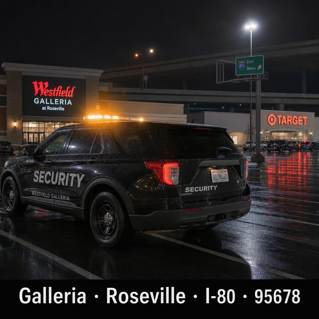
Arden-Arcade
Search intent · arden arcade sacramento · arden fair sacramento · arden park
Overview
Arden-Arcade is the unincorporated belt east of downtown — Arden Fair Mall, Howe About Arden, Country Club Plaza, Loehmann's Plaza, and the residential pockets of Arden Park, Arden Manor and Sierra Oaks.
Safety context (informational)
Crime exposure varies sharply by sub-pocket. Retail corridors around Arden Way and Watt Ave see elevated theft and vehicle crime per Sheriff's reporting. Residential Arden Park and Sierra Oaks track near county median.
Patrol coverage on this street
Stormhammer runs after-close storefront sweeps along Arden Way, lot patrols at Arden Fair and Country Club Plaza adjacent properties, plus residential HOA drive-by in Arden Park.
Arden-Arcade patrol mini-map
Click a neighbor pin to jump to that city's patrol page.
Service-area map · scroll to load
- Is Arden-Arcade safe?
- Crime exposure varies sharply by sub-pocket. Retail along Arden Way and Watt Ave reports elevated theft and vehicle crime per Sheriff data; residential Arden Park and Sierra Oaks track near county median.
Meadowview
Search intent · meadowview sacramento · is meadowview sacramento safe
Overview
Meadowview is a South Sacramento community along Meadowview Rd between SR-99 and the Pocket. Light rail Meadowview Station, John Still K-8, and a long stretch of single-family neighborhoods backing onto Valley Hi.
Safety context (informational)
Meadowview / Valley Hi reports above-average property crime per Sacramento PD CompStat. Resident sentiment in the area has improved since the Meadowview Community Action Plan rolled out additional lighting and street furniture.
Patrol coverage on this street
We patrol apartment communities and HOAs around Meadowview Rd and Detroit Blvd with randomized drive-by, breezeway foot-walks and amenity lock-ups.
Meadowview patrol mini-map
Click a neighbor pin to jump to that city's patrol page.
Service-area map · scroll to load
- Is Meadowview Sacramento safe?
- Meadowview / Valley Hi reports above-average property crime per Sacramento PD CompStat. Sentiment has improved since the Meadowview Community Action Plan added lighting and street furniture along Meadowview Rd.
Stockton Blvd Corridor
Search intent · stockton blvd sacramento · stockton blvd
Overview
Stockton Blvd runs from Oak Park through Tahoe Park, Lemon Hill, Florin and into Vietnam Town and Little Saigon. It's one of the most diverse commercial corridors in the city — groceries, restaurants, dental, urgent-care, and the new Aggie Square anchor at the north end.
Safety context (informational)
Property crime exposure on Stockton Blvd is concentrated at unattended retail lots, vacant buildings and motels. Coordinated visible patrol reduces vehicle break-ins and loitering significantly in published case studies.
Patrol coverage on this street
Stormhammer runs storefront and motel lot patrol along Stockton Blvd — multi-tenant lot sweeps, lock-up checks at the auto-shop and tire corridor near 47th Ave, and after-close perimeter on the Pho and Banh Mi restaurants.
Stockton Blvd Corridor patrol mini-map
Click a neighbor pin to jump to that city's patrol page.
Service-area map · scroll to load
- Is Stockton Blvd Sacramento safe?
- Property crime exposure on Stockton Blvd concentrates at unattended retail lots, vacant buildings and motels. Coordinated visible patrol reduces vehicle break-ins and loitering significantly per published case studies.
Mack Road / Valley Hi
Search intent · mack road sacramento · valley hi park · mack road valley hi community center
Overview
Mack Road anchors Valley Hi / North Laguna — Valley Hi Community Center, Promenade Shopping Center, Cosumnes River College, and a band of apartment communities between Stockton Blvd and Franklin Blvd.
Safety context (informational)
Mack Rd has historically been on Sacramento PD's higher-call-volume list for property crime and disturbances at multi-tenant retail. Coordinated property-manager patrol programs along the corridor show consistent reduction in repeat-call addresses.
Patrol coverage on this street
We run breezeway foot-walks at Mack Rd / La Mancha Way apartment communities, parking lot sweeps at Promenade and the Mack Rd grocery anchors, and after-hours patrol at the Valley Hi medical buildings.
Mack Road / Valley Hi patrol mini-map
Click a neighbor pin to jump to that city's patrol page.
Service-area map · scroll to load
- Is Mack Road Valley Hi safe?
- Mack Rd has historically been on SacPD's higher-call-volume list for property crime and disturbances at multi-tenant retail. Property-manager patrol programs along the corridor show consistent reduction in repeat-call addresses.
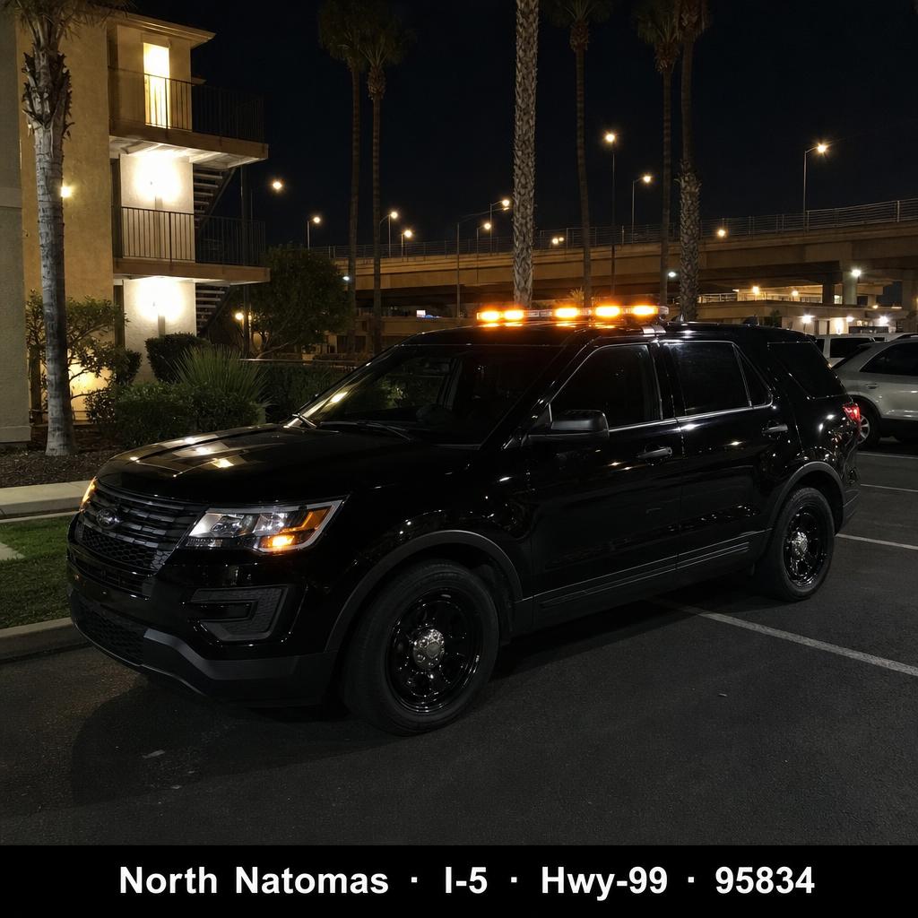
Natomas (North & South)
Search intent · is natomas safe · is north natomas safe · is south natomas safe
Overview
Natomas is the I-5 / SR-99 wedge north of the American River — North Natomas is the newer master-plan side with the Sleep Train Arena footprint, big-box retail at Truxel and Del Paso, and the Sacramento Kings practice facility. South Natomas is the older side along Garden Hwy and West El Camino.
Safety context (informational)
North Natomas tracks at or below Sacramento city median for most crime categories per public CompStat. Parts of South Natomas around West El Camino and Truxel report higher vehicle and property crime. Visible patrol pays back fastest on those parking-heavy multi-family blocks.
Patrol coverage on this street
Natomas is one of our largest patrol routes. Apartment patrol, HOA tours and storefront sweeps in Natomas Park, Westlake, North Park and the East Commerce / Truxel retail belt. Same $15/visit, same sunrise PDF.
Natomas (North & South) patrol mini-map
Click a neighbor pin to jump to that city's patrol page.
Service-area map · scroll to load
- Is Natomas safe?
- North Natomas tracks at or below Sacramento city median for most crime categories. Parts of South Natomas around West El Camino and Truxel report higher vehicle and property crime.
- Is North Natomas safe?
- North Natomas (95834, 95835) tracks at or below the Sacramento city median for most crime categories and is anchored by the Sleep Train Arena footprint, North Natomas Regional Park and the Truxel / Del Paso retail belt.
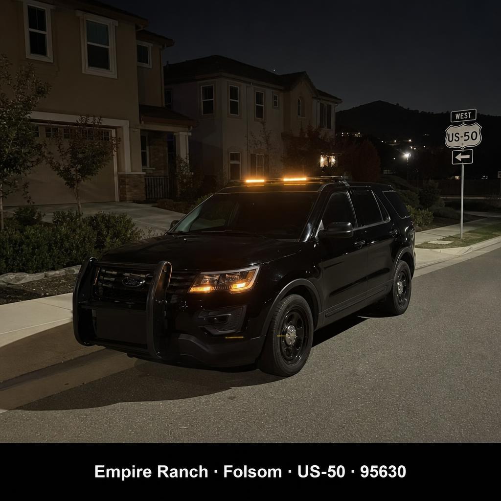
Folsom
Search intent · folsom ca crime rate · folsom sacramento · folsom ca
Overview
Folsom sits on US-50 east of Sacramento — Historic Sutter Street, Folsom Lake, Palladio at Broadstone, Empire Ranch and the Intel Folsom campus.
Safety context (informational)
Folsom is consistently ranked among the safer cities in the Sacramento metro by FBI UCR data, well below state averages for violent crime. Property crime mirrors retail traffic around Palladio and the East Bidwell corridor.
Patrol coverage on this street
Folsom patrol covers Empire Ranch HOAs, Palladio retail lot patrol, Broadstone apartments and Historic Sutter Street after-close lock-ups. Same marked SUV, $15/visit.
Folsom patrol mini-map
Click a neighbor pin to jump to that city's patrol page.
Service-area map · scroll to load
- What is Folsom's crime rate?
- Folsom is consistently ranked among the safest cities in the Sacramento metro by FBI UCR data — well below state averages for violent crime. Property crime mirrors retail traffic around Palladio and the East Bidwell corridor.
Elk Grove
Search intent · elk grove ca · moving to elk grove ca · elk grove neighborhoods
Overview
Elk Grove is the largest South-of-Sacramento city — anchored by Laguna Blvd, the Elk Grove Auto Mall, Elk Grove Promenade outlets, and the bedroom communities of Laguna West, Anatolia and Stone Lake.
Safety context (informational)
Elk Grove tracks among the safer larger cities in California per FBI UCR data. Property crime concentrates at retail anchors along Laguna Blvd and Elk Grove Blvd.
Patrol coverage on this street
We patrol apartment, HOA and new-development inventory across Elk Grove — Laguna West, Anatolia, Stone Lake and the East Franklin growth corridor.
Elk Grove patrol mini-map
Click a neighbor pin to jump to that city's patrol page.
Service-area map · scroll to load
- Is Elk Grove safe?
- Elk Grove tracks among the safer larger cities in California per FBI UCR data. Property crime concentrates at retail anchors along Laguna Blvd and Elk Grove Blvd.
Rancho Cordova
Search intent · rancho cordova safe · is rancho cordova safe
Overview
Rancho Cordova straddles US-50 east of Sacramento — anchored by Sunrise Blvd, the Mather business park, Anatolia and Sunridge master-plan communities, and the Aerojet / Folsom Blvd corridor.
Safety context (informational)
Rancho Cordova has invested heavily in PD staffing since incorporation. Property crime exposure concentrates on the older West Rancho apartment blocks along Folsom Blvd and Mills Station; newer master-plan east-side communities track at or below county median.
Patrol coverage on this street
Anatolia, Sunridge, Stonecreek and the Folsom Blvd / Mills Station apartment belt all get nightly drive-by, breezeway walks and lock-ups.
Rancho Cordova patrol mini-map
Click a neighbor pin to jump to that city's patrol page.
Service-area map · scroll to load
- Is Rancho Cordova safe?
- Rancho Cordova has invested heavily in PD staffing since incorporation. East-side master-plan communities (Anatolia, Sunridge, Stonecreek) track at or below county median; West-Rancho apartment blocks along Folsom Blvd report higher property crime.
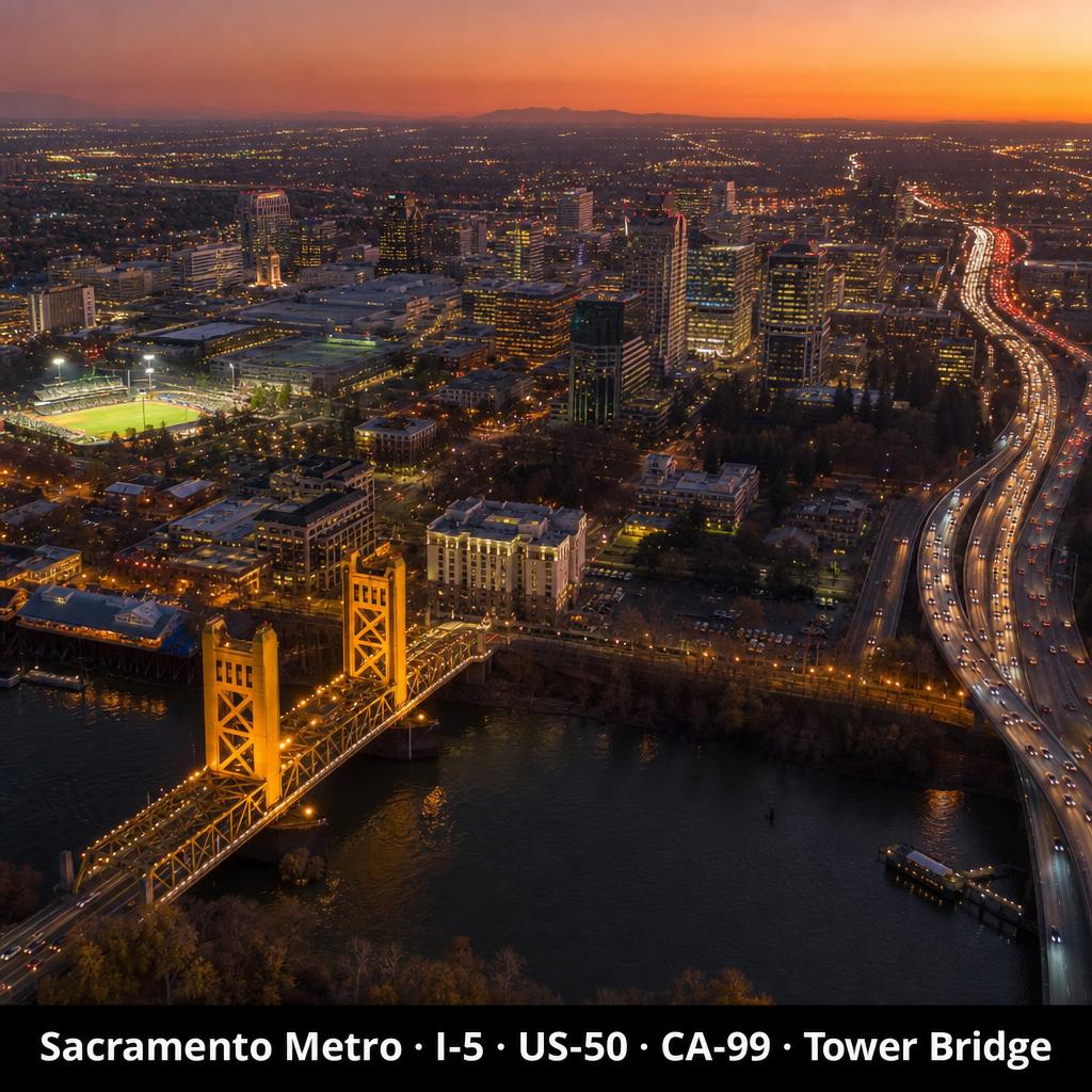
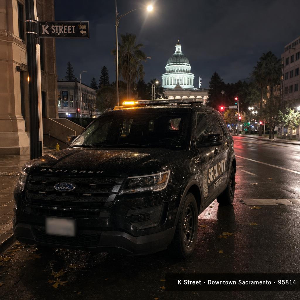
Downtown & Midtown Grid
Search intent · sacramento parking downtown · downtown sacramento · midtown sacramento
Overview
Downtown is the Capitol / DOCO / K-Street grid. Midtown is J–R Streets and 16th–28th — the cocktail, gallery and restaurant grid that drives most weekend foot traffic.
Safety context (informational)
Downtown / Midtown sees the foot traffic that comes with a state capital — petty theft and vehicle break-ins concentrate around event nights at Golden 1 Center, K Street and the Capitol Mall garages.
Patrol coverage on this street
After-close storefront sweeps, parking-garage perimeter checks, and event-night supplemental patrol on K Street, J Street and the Midtown grid.
Downtown & Midtown Grid patrol mini-map
Click a neighbor pin to jump to that city's patrol page.
Service-area map · scroll to load
- Where can I park in downtown Sacramento?
- Downtown Sacramento parking concentrates in the Capitol Mall garages (1100 J, 11th & K), the DOCO / Golden 1 garage at L Street, the Old Sacramento riverfront garages, and metered on-street parking on J–R Streets. Most garages run $10–$25 for evening events; expect surge pricing on Kings game nights.
- Is downtown Sacramento safe at night?
- Downtown / Midtown sees the foot traffic that comes with a state capital. Petty theft and vehicle break-ins concentrate around event nights at Golden 1 Center, K Street and the Capitol Mall garages — keep valuables out of view and prefer garages with attendants.